Salpausselkä ridges and chains of eskers
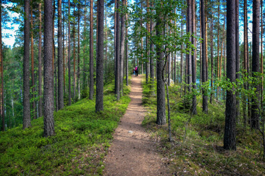
The Salpausselkä ice-marginal formations, left behind by the last Ice Age some 12 000 years ago, are the best-known geological features of Finland. In the Lahti Region they are at their most spectacular, forming a unique, diverse landscape of ridges, kettle holes, steep slopes and raised beaches. The narrow eskers to the north of Salpausselkä offer lovely walks and views.
Most people perhaps associate the name Salpausselkä with winter sports. The Lahti Ski Games at Salpausselkä (known as Salpausselkä Games in Finland) is an international winter sports event that has been held annually since the 1920s. This event is an integral part of the region’s cultural history and appeal. The FIS Nordic World Ski Championships have been held here seven times.
But how did this location come to host events such as the World Championships? The answer lies in its geology. The impressive kettle hole landscape of the First Salpausselkä in the city of Lahti by Lake Vesijärvi was formed through the melting of enormous ice blocks that split off from the continental ice sheet and were buried in the gravel and sand at the end of the last Ice Age. This landscape with steep slopes provides excellent terrain for winter sports, and the Lahti Sports Centre grew around international cross-country skiing and ski jumping competitions.
The best-known geological entity of Finland
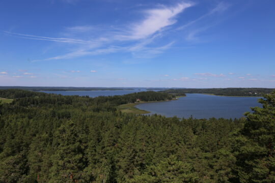
However, Salpausselkä is much more than a winter sports destination. In fact, there are two Salpausselkä ridges that run through the Lahti region. The Salpausselkä ridges, left behind by the last Ice Age, are Finland’s best-known geological entity. Salpausselkä Geopark promotes the geological heritage of the region where these landforms, reaching across the entirety of southern Finland, are at their most spectacular.
The Salpausselkä ridges were formed along the margin of the continental ice sheet during the melting phase of the last Ice Age, when a period of rapid cooling stopped the ice sheet from retreating further. The cold period, known as the Younger Dryas, started about 12,800 years ago and lasted for approximately 1,200 years. The meltwaters running in tunnels and cracks inside the ice sheet transported and sorted gravel and sand, which were then deposited as deltas at the mouths of glacial rivers in the Baltic Ice Lake. One of these delta deposits is where Lahti Sports Centre was located some 12,000 years later.
One of the most impressive points of the Second Salpausselkä is Aurinkovuori Hill, where an unusually thick delta deposit composed of up to 130 metres of mostly gravel and sand has built up on top of the bedrock. The soil depth in Finland is normally less than 10 metres.
Eskers were left behind by ancient glacial streams
The ancient meltwaters deposited gravel and sand not only at the margin of the ice sheet, but also as eskers at the bed and mouths of the glacial streams. Thus, also the numerous winding eskers to the north of Salpausselkä, running parallel to the direction of the glacier’s movement, are reminders of the final stages of the Ice Age. Some of these eskers are located in Päijänne National Park, which forms a part of the Salpausselkä Geopark area. The stunning esker system, created as the continental ice sheet and the glacial streams moved, can be easily seen in the Salpausselkä Geopark area. The most beautiful eskers include Pulkkilanharju in Asikkala, Kelvenne Island in Padasjoki and the chain of eskers north of Vierumäki in Heinola.
Numerous kettle holes, large funnel-shaped pits in the ground, can be found around the Salpausselkä ridges and the eskers. The kettle holes were formed when huge blocks of ice, detached from the receding glacier, were buried in gravel and sand deposited by the meltwaters. As the ice blocks slowly melted, the layer of soil covering the ice collapsed. Some of the kettle holes are filled with water and called kettle ponds or kettle lakes.
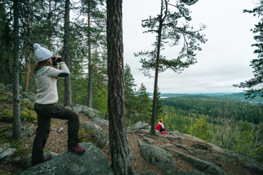
Today the glaciofluvial landforms – Salpausselkä ridges and the eskers – offer stunning views and peaceful walks, but are also vitally important for the wellbeing of the communities: their thick sand and gravel layers absorb most of the annual rainfall feeding the renewable groundwater reserves and providing the local people with drinking water of the highest quality.
Forest trails and scenic views
Aurinkovuori Hill
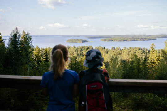
Aurinkovuori Hill is a magnificent ice-marginal ridge that forms a part of the Second Salpausselkä. An exceptionally thick layer of soil has accumulated on the bedrock at Aurinkovuori – at its thickest up to 130 metres of mostly sand and gravel that was transported and sorted by the glacial streams. Aurinkovuori Hill is situated between the lakes Päijänne and Vesijärvi, and offers beautiful views over both of them from the trails and campfire site.
Kapatuosia Hill Fort, Hollola
Kapatuosia is a steep-sided ridge that was formed by the meltwaters of the continental ice sheet about 12,000 years ago. Archaeological excavations at the site have uncovered remnants of wooden structures. On top of the hill there is a viewing tower, which visitors can climb to enjoy the beautiful views over Lake Vesijärvi. At the foot of the hill lies the grand medieval church of Hollola.
Vierumäki, Heinola
Vierumäki is located on the sandur and delta plains of the Second Salpausselkä, formed of sand and gravel deposited at the margin of the continental ice sheet nearly 12,000 years ago. North of the Vierumäki Resort & Sport Institute of Finland, Salpausselkä is joined by eskers formed of sand and gravel in meltwater tunnels or cracks in the ice sheet. Visitors can experience the picturesque scenery on nature trails, which run along the narrow and steep-sided eskers, surrounded by small lakes. Vierumäki Resort offers a wide range of activities and services.
All nature attractions
The First and Second Salpausselkä ridges, the long chains of eskers, magnificent rock formations and hundreds of lakes dotted with islands create a landscape with breathtaking scenery and of unique geological interest. Salpausselkä Geopark is full of interesting sites to visit – welcome!